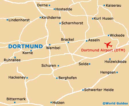
Dortmund Airport (DTM)
City Orientation and Maps
(Dortmund, Germany)
Standing on the western side of Germany, Dortmund is known for being the second-biggest city in the whole of the Ruhrgebiet area and is home to a rich brewing heritage. Dortmund is a particularly historic city and dates back to the end of the 9th century, when the settlement was first formed.
Those flying into the city will arrive at Dortmund Airport (DTM), located to the east. There are also numerous motorways and main roads surrounding Dortmund, making it easy to reach from all over Germany.
Dortmund Airport (DTM) Maps: Important City Districts
Many of the city's main sights, including a number of historic churches, are surrounded by the ring road and include the Konigswall area, which is close to Dortmund's train station (Hauptbahnhof) and bus station (Busbahnhof). The city's tourist office is located at the southern exit of the train station, nearby the modern library. Walking tours of central Dortmund are available and offer a good way to get to know the city and its numerous neighbourhoods.
The Westenhellweg area of Dortmund is located nearby, being well pedestrianised and full of shops. No trip to this district is complete without viewing the immense altar sculpture, which was created in the early 16th century. This main thoroughfare leads towards Dortmund city centre, an important area of commerce, where a number of large banks reside.
Germany Map

Dortmund Map